

Looking to Connect?
Contact Us
Directions & Maps
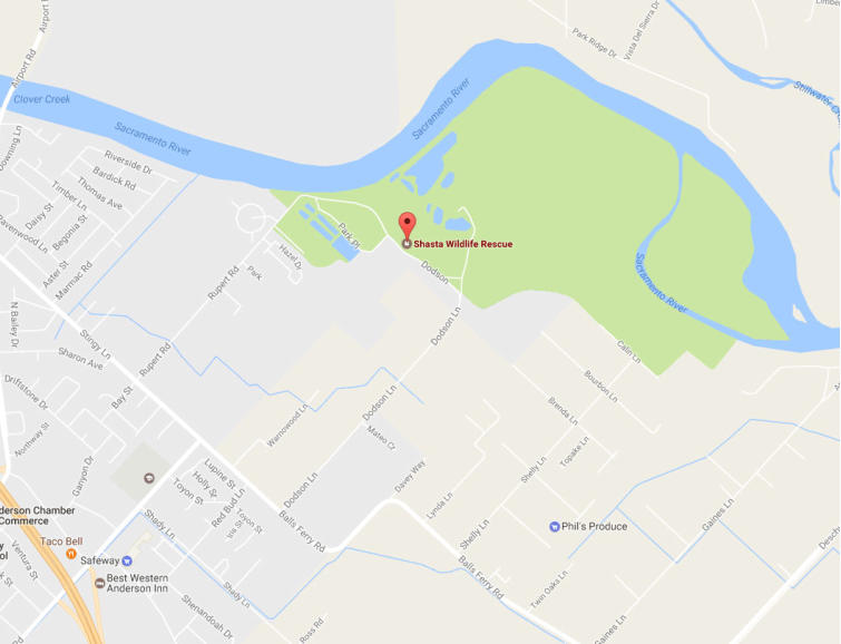
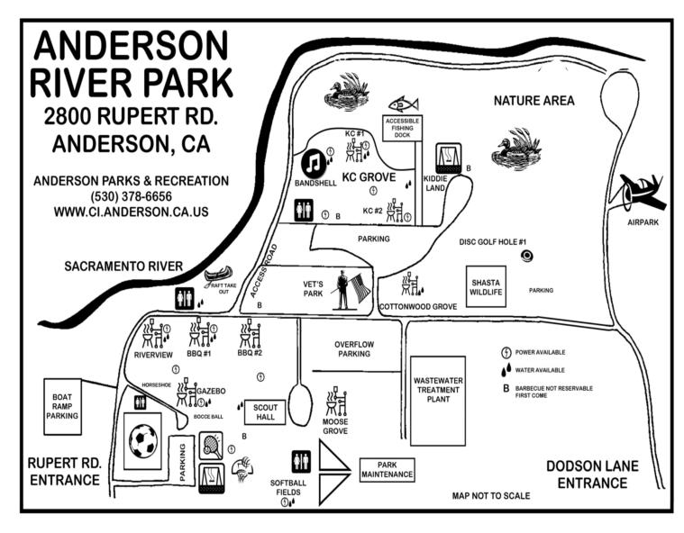
Find our rescue facility in Anderson, California
Our Facility
Our facility is located in Anderson River Park at 3752 Rupert Road, Anderson, California. For staffing and hours of operation see our About Us web page.
GPS: Elevation: 386 feet — Latitude: 40°27.937′ N — Longitude: 122°16.396′ W
Not open to public — by appointment only
Driving Directions
From the South
Traveling north on I-5 take the Central Anderson turn off, which is exit #668. Turn right at the light which is Balls Ferry Road. Proceed about 1/2 mile to the stop sign at Stingy Lane and turn left. Go about 1/4 mile to a 4-way stop which is Rupert Road. Go right and follow it into the park.
From the North
Traveling south on I-5 take the North Street, Balls Ferry, Anderson turn off, which is exit #668. Turn left at the stop sign which is North Street. Proceed about 1/2 mile to a stop sign at Stingy Lane and turn right. Go about 1/3 mile to a 4-way stop which is Rupert Road. Go left and follow it into the park.
When you are in the park: Go past the picnic area and Kiddieland KC Grove. The SWRR facility is a brown building on the left with a large gravel parking lot, just before you reach Dodson Lane.
Need to Reach Us?
Remember: all animal intakes require a phone assessment first. Call our hotline before visiting.